Have You Read Devil in the White City?
|
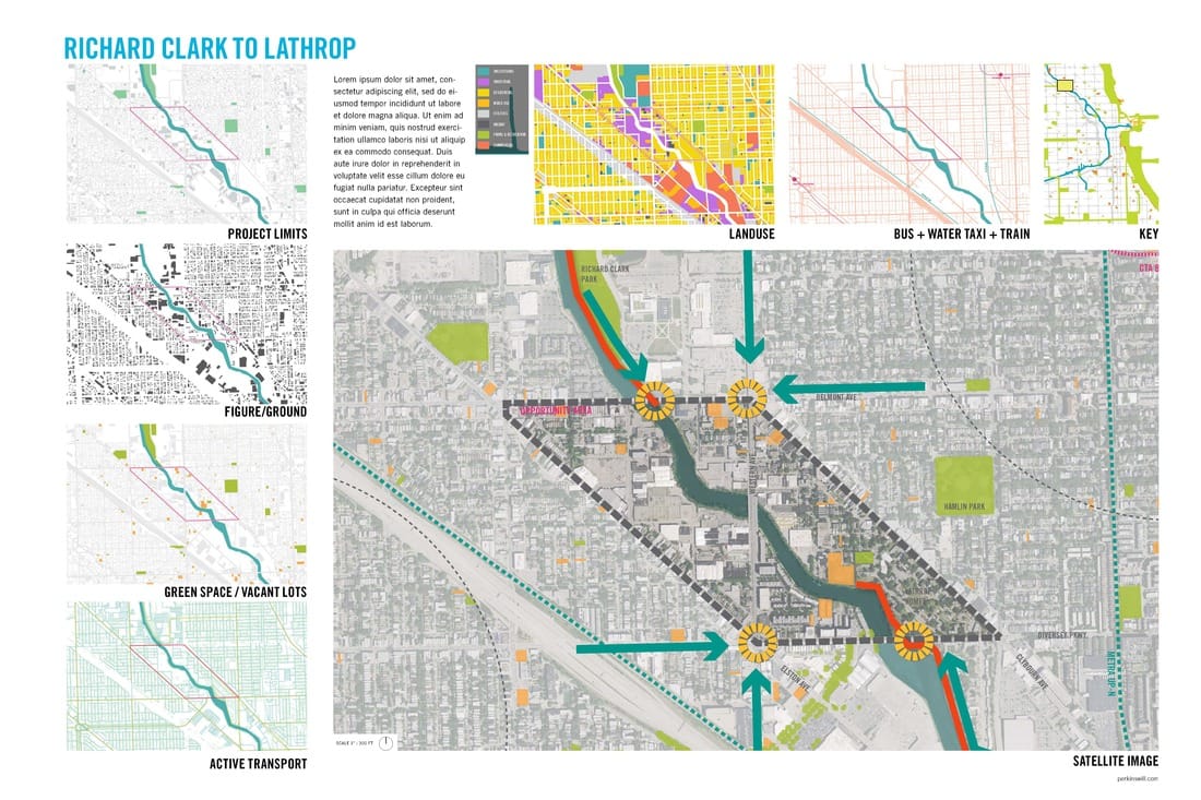
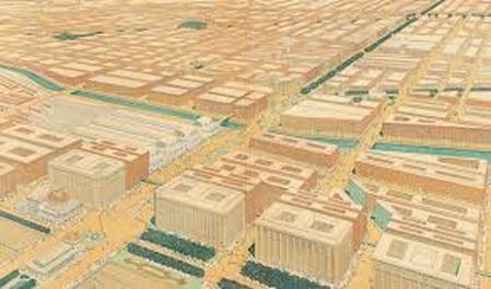
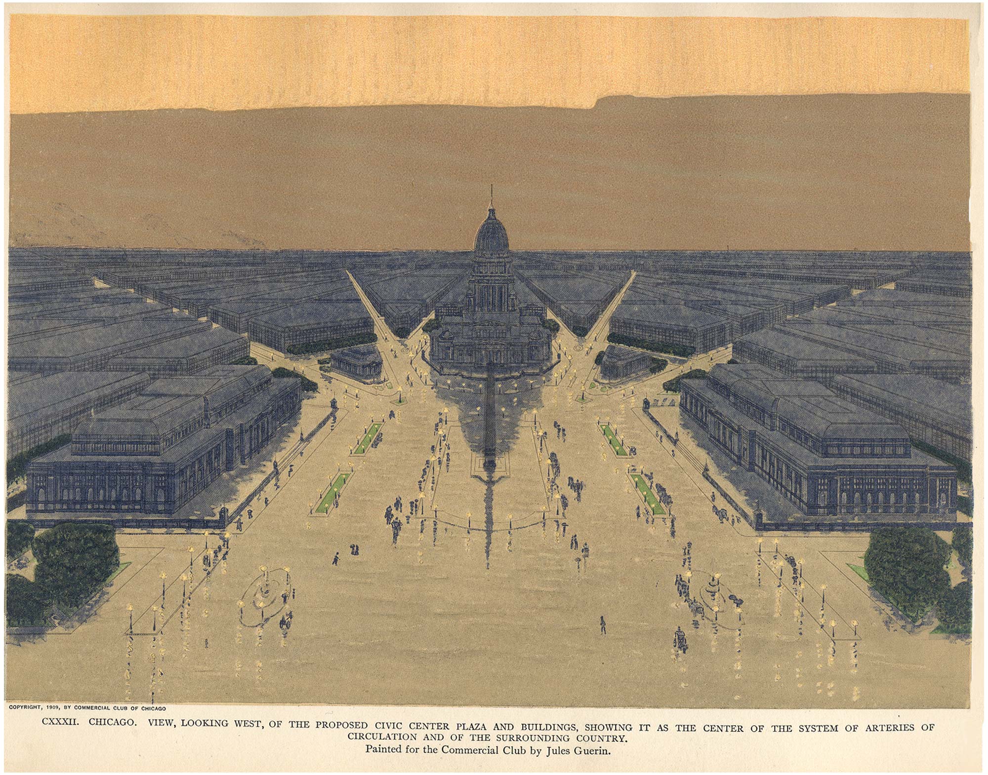
Daniel Burnham published a master plan for the City of Chicago in 1909. The backbone of much of the plan circulated around connections. To the right is a digital recreation of the plan.
Original 1909 Burnham Plan
|
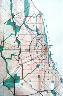
Digitized Version of the plan using GIS
|
A Big City With a Big Plan
The Devil in the White City: Murder, Magic, and Madness at the Fair by Erik Larson is an iconic text in Chicago. The fictional text illuminates the history of Chicago's planning and architecture through the backdrop of a murder mystery. Burnham's plan was the crowned jewel of that World's Fair, but like most plans at the time, the Burnham plan was never implemented. Remnants of it still exist in the city in small scale and in concept. Is it possible to still apply the principals of connectivity to the existing design of Chicago?
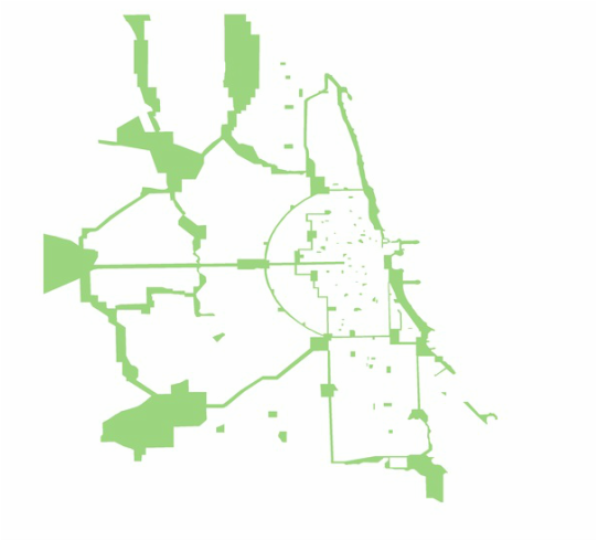
Below is a map of Chicago overlayed with the Burnham plan in medium green. The scale of the original plan far exceeds the boundaries of the city. Forest preserves are in lime, and parks / existing tree canopy are in forest. In many cases Burnham incorporated the forest preserves into his plan, and some of the boulevards on the south and west sides of Chicago actually were constructed / preserved.
Below is a map of Chicago overlayed with the Burnham plan in medium green. The scale of the original plan far exceeds the boundaries of the city. Forest preserves are in lime, and parks / existing tree canopy are in forest. In many cases Burnham incorporated the forest preserves into his plan, and some of the boulevards on the south and west sides of Chicago actually were constructed / preserved.
Where to Start? Let's Look at the Building Blocks!
|
Burnham's plan was a big one, but it can be reduced to a few central concepts. Again, as with many plans from that era, connectivity and access were central. With Chicago being flat, the city offered a fairly blank canvas to envision long linear connections through out the city with a radial loop encircling the central downtown business district (now known as the Loop). Many of these arterials never saw fruition, although the vast majority of the city is built on linear grids. These assets are still very prominent in Chicago and are the backbone way finding in Chicago.
|
|
Creating Connections
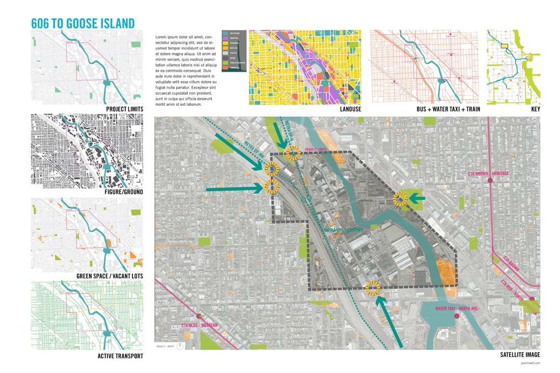
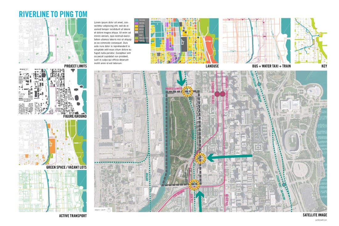
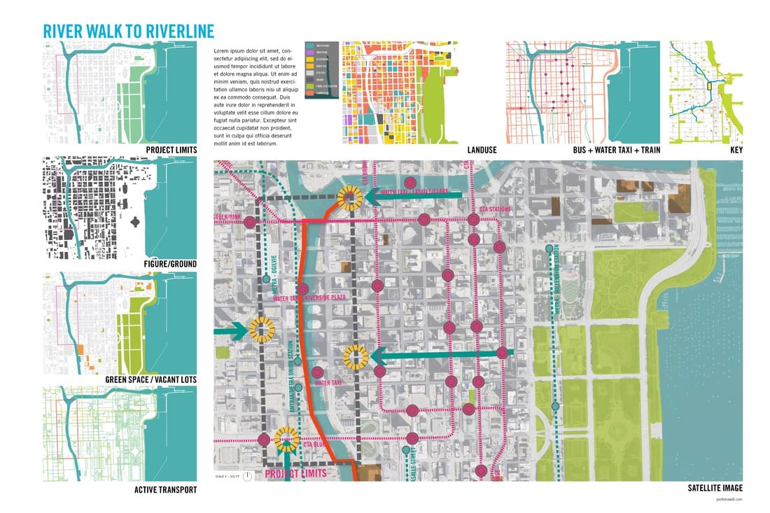
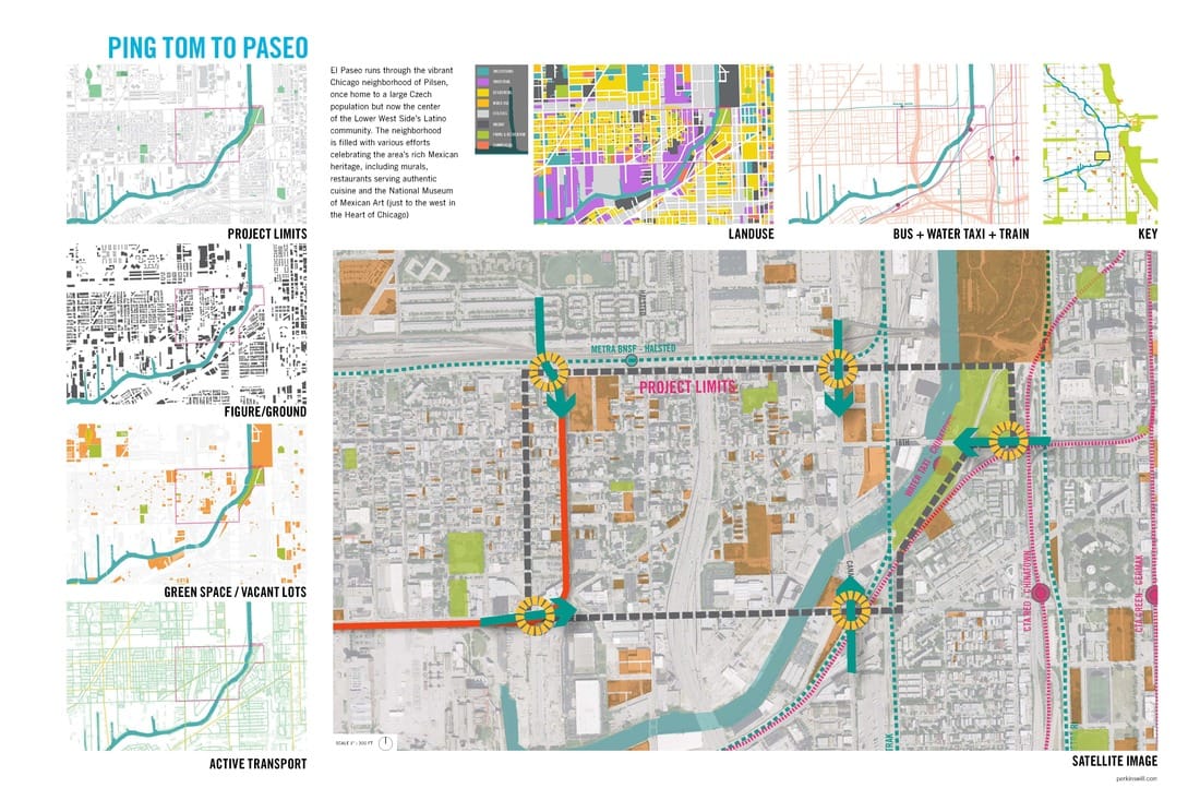
The identification of disconnection is the first key to finding opportunities. If key junctions can be made between existing and proposed projects within the city, then opportunities for design interventions can arise!
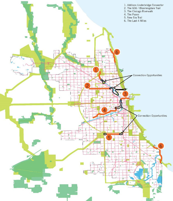
To the left is a map of key intervention spaces. 1-6b are all existing or proposed segments of existing trails, the gaps are identified in black.
These connection opportunities offer various project opportunities such as Transit Oriented Development, trail extensions, possible architectural features, pocket parks, etc. To better understand these sites, a basic site analysis would likely need to be executed.
Connecting the Connections
|
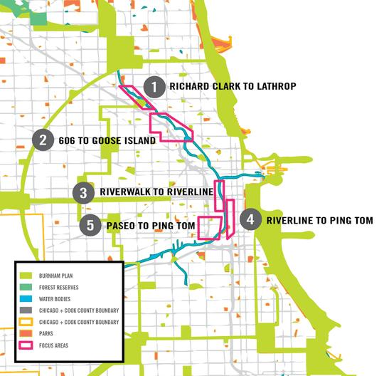
Five gaps in connection were identified in our study. These spaces offer one or more types of connection to existing pathways and networks. These spaces offer furtile development oppertunities for transit, housing, recreation, education, and much more.
|
|