Walk-ability is the Goal
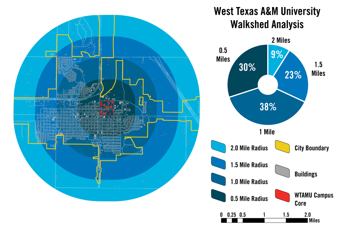
As part of a second phase of work, we were asked to look at a walkshed analysis. Using the county's GIS data, we calculated the number of buildings within 0.5, 1.0, 1.5, and 2.0 miles of the campus. The goal was simple: understand what is within walking distance of campus (0 - 1 mile) and what was within biking distance (1 - 2 miles). This information would hopefully inform a capital improvement plan to improve walk-ability and bike infrastructure around campus. Below is the generated graphic.