An Urban Bike Trail as an Economic Development Tool
Wasson Way is a decommissioned commercial rail line that runs east from a prominent Cincinnati neighborhood and educational institution. The rail line stretches about 5 miles east into the suburbs and passes through about a half dozen neighborhoods and two business districts. A few years ago, an interest group came together to discuss the possibility of converting this rail line to a bike trail.
This study investigated the economic impact the rail line would have on surrounding property values.
This study investigated the economic impact the rail line would have on surrounding property values.
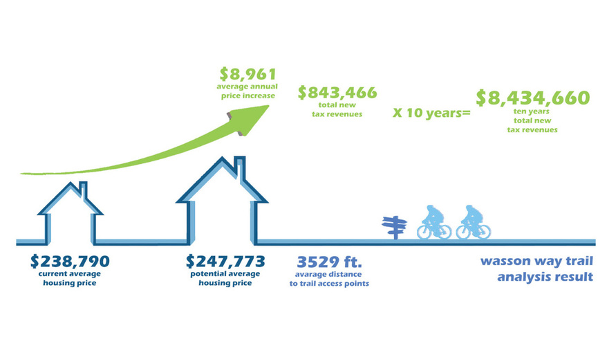
Resulting Findings of the Study
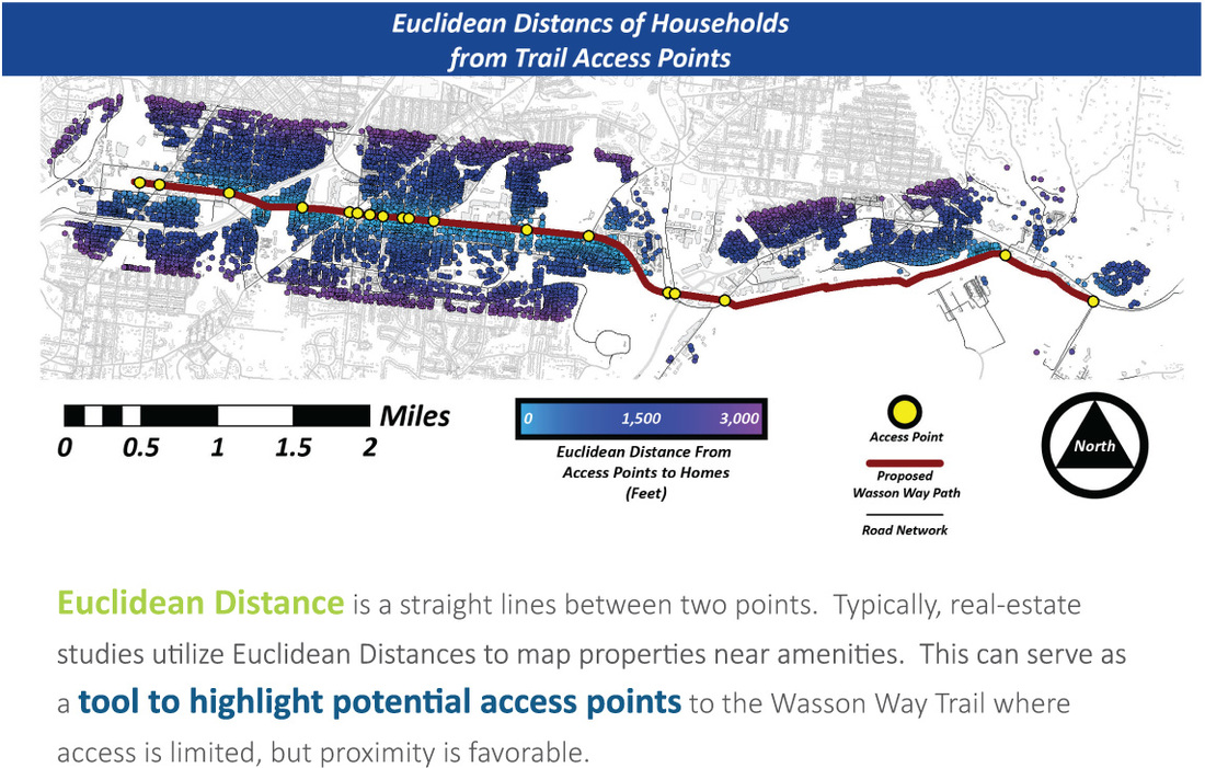
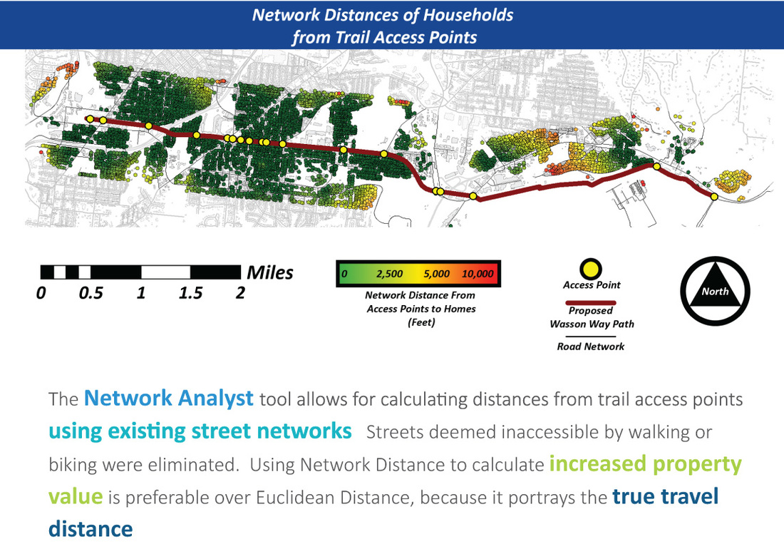
Two Methods of Measuring Distance
Using a validated study, it was determined that there was a calculable correlation between the distance of a property from the trail and the expected increase of the property's value. Euclidean distance would obviously give a good estimate of the end results, but would lack the understanding of natural barriers created by other properties or lack of access. Network distances were calculated using GIS and produced distances from proposed trailheads to properties. These results provide stronger results, as most riders would use the existing road network to connect Wasson Way.
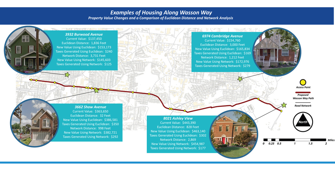
Example Assessments
Below are some example properties and the expected outcomes based on the calculations that were performed.