Reviving a Century Old Plan in a Modernized City
|
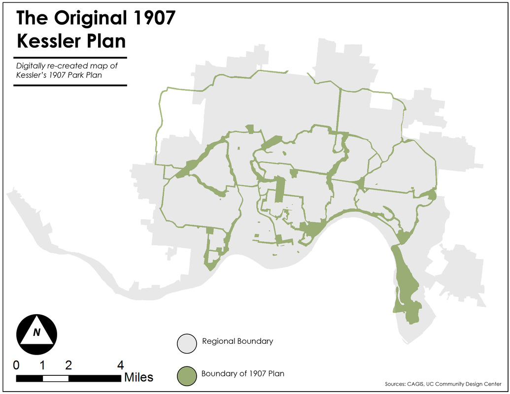
In 1907 Cincinnati drafted a regional park plan. The plan was ambitious and sought to alleviate the ills of urban living (largely in form of health concerns). This was to be accomplished by creating a series of urban parks, parkways, and network connections for multi-model transit. The plan was never carried out due to budgetary constraints and lack of political support.
|
|
Making Use of Neglected Spaces
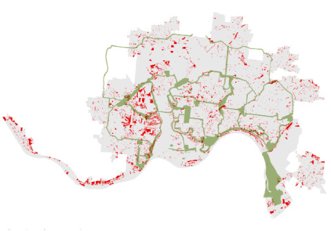
Vacant Lots
Misc. Pavement
Streets, Highways, and Existing Parks
|
Could a new park plan come together through the innovative reuse of underutilized land? Spaces like brownfields, highways, and urban parking lots offer unique spaces of low financial value, but are often located in spaces that are in desperate need of green space.
Through a visualization procedure of these elements a series of maps was generated to show these features in space. These spaces were then combined to a single shape with can be considered "viable spaces" for additional green spaces in the city. That map is visualized below. 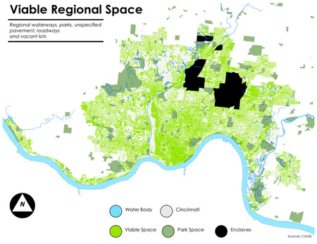
|
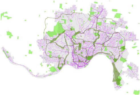
A New Plan on a Smaller Scale
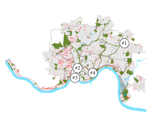
The above exercise promises a great deal of potential, but its obviously not possible to convert all of that space to green space. What sorts of spaces and environments could serve as the "best" templates for creating a new park network? Below are four spaces from various spaces in the city that could serve as options.
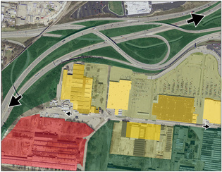
Suburban Infill
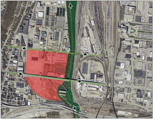
Post-Industrial Redevelopment
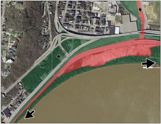
Riverfront Redevelopment
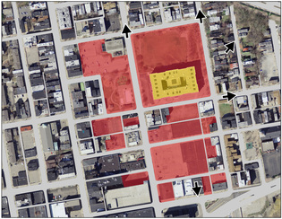
Urban Infill
|
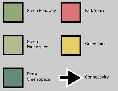
Type 1: Suburban Infill - Highways, large facility roofs, parking lots and wide streets become templates for reforestation and stormwater control
Type 2: Post-Industrial Redevelopment - Former industrial sites become the location of restored streams, forest, and recreation space Type 3: Riverfront Redevelopment - Riverfront parking and shipping yards convert to linear green space to connect the eastern side of Cincinnati to the west. Type 4: Urban Infill - Urban parking lots, vacant lots, and derelict property shifts to neighborhood parks and greener street designs. |
Below is a link to a hardcopy of my Master's Thesis.
